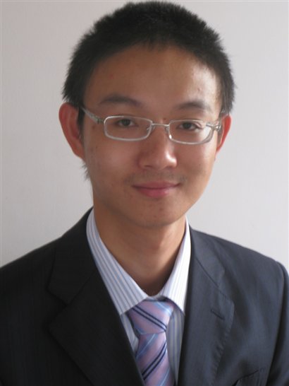


All Firsts For First "2 + 2" Student

Ruiyuan Li managed to clock up a lot of firsts in the two years he spent finishing his degree at the School of Surveying and Geospatial Engineering at UNSW.
Not only was he the first person to travel from China as part of the 2 + 2 study program-for students who have completed two years of their degree at a Chinese University-but he was the first to enroll in the Geospatial Information Systems degree and then, of course, the first to graduate.
But that wasn’t the end of the top spots. Moving straight in to Year Three of his degree course once here, he managed to pick up both the Faculty of Engineering Dean’s Award and the AAM Prize for the best academic performance at the end of the year.
By the time he graduated though he’d done even better. He won the Board of Surveying & Spatial Information Gold Medal for the top student in final year, while also taking out the Spatial Sciences Institute, Remote Sensing & Photogrammetric Division Prize, the RS Mather Memorial Prize for outstanding performance in Geodesy/GPS, and the Institution of Surveyors NSW Prize for the best overall performance in the graduating year.
We should also mention that he also got a first class honor for his degree and then won a scholarship for the summer of 2010 to undertake what is called a ‘Taste of Research program’
‘I did work very hard,’ Ruiyuan said, in what no doubt underestimates both his natural talent and some of the challenges he faced in moving here to study.
‘I had been learning English at Wuhan University, but getting on top of the language here, especially with the Australian accent, was probably the hardest thing I faced.
‘There are obstacles it’s true, but I was also lucky to get a lot of support from my teachers and especially from Jinling Wang, Linlin Ge and Bruce Harvey,’ Ruiyuan said.
In fact it was a visit by Associate Professor Jinling Wang to Wuhan University - the alma mater of both Associate Professors Wang and Linlin Ge as it turns out - that got Ruiyuan interested in the 2 + 2 program in the first place and then to apply to enrol in the GIS degree in Sydney.
While Ruiyuan now works full-time as a cadastral surveyor with Sydney firm Eric Scerri & Associates - he in fact got offered a number of jobs when he graduated - he says he’s open minded about where his career might go.
‘I’d done a number of geospatial type subjects in my first two years at Wuhan University and I find that you mix the two approaches any way just in cadastral surveying,’ he said.
'I am enjoying this work and I know that surveying and GPS are also very big in China right now, especially as the country is launching its own navigational satellite system under the name of COMPASS.'
Certainly Ruiyuan’s Final Year thesis and his Taste of Research report effortlessly mix surveying and geospatial skills. For his thesis, for instance, he looked at how online street views like Google’s will soon become geo-referenced to provide not only a panorama view and maps, but also 3-D position information.
'That will be revolutionary for surveying as it will improve the efficiency of road maintenance, asset management, coastal mapping, city modeling and mining through accurate point measurement, distance measurement and angular measurement,' Ruiyuan said.
Ruiyuan is heading toward registration as a surveyor in NSW and says that he then plans to get as much experience as he can.
'Coming here was such a great experience and I’d like to stay here for the immediate future any way, but then who knows.'
注:李瑞源(Ruiyuan Li)是武汉大学测绘学院2007级测绘工程专业本科生,2010-2011年参加武汉大学与澳大利亚新南威尔士大学的”2+2”联合培养计划,获得武汉大学毕业证和双方学位证。